Apply for trial Check the video

Apply for trial Learn more
DTS digital twin platform independently developed by Freedo provides a perfect solution from raw data to final application presentation. It is a spatial data governance tool with explosive performance, a powerful digital twin scene construction editor, and has the characteristics of revolutionary 3D vector slicing technology, cloud rendering technology, doubled SDK secondary development interface, and meets the characteristics of zero-code development. Meanwhile, the platform also supports cluster deployment, and the UI design is fashionable and cool.
DTS digital twin platform, relying on the "multi-source data conversion and 3D slice lightweight" technology of iFreedo, has the advantages of "city-level and large-scale data conversion and bearing", which can solve the problems of "difficult unification and governance of multi-source data, and stuck loading of large-volume data", and realize the effect of "city-level large-scene digital backboard construction and multi-terminal display".
Study and Support
Learn how to use DTS
from scratch
User Manual
Provide complete solutions
for digital twins
FAQ
What you want to ask will
all be answered
Configuration
Get the best out of DTS
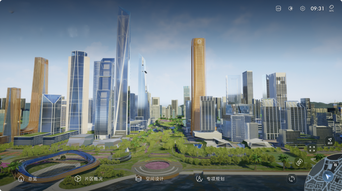
DTS digital twin scenarios are data bodies with the characteristics of "full space, all elements, whole process, multi-scale, and computable", which can support the construction of digital backboards for multiple industries, fields, and needs, and can be connected to AI algorithms and IoT systems to achieve "twin" construction and support multi-terminal display.
DTS digital twin platform greatly lowers the threshold for digital twins, deeply explores the core value of spatial data, and empowers partners to focus on creating business value.
Provide complete solutions from raw data to final 3D rendering.

Engine
Multi-source data processing tool

Explorer
Digital twin scenariobuilder and editor

Cloud
Cloud renderingvideo streams

SDK
Quickly build digitaltwin applications

Charts
Zero codedevelopment tool
Visual feas
DTS’s five major differences


Multi-Source Data Governance Capabilities
Data fusion:Support all common spatial data format standards.
Semantics:AI understands the model, allowing the machine to read the content.
Data management:dynamic updates, automatic synchronization of database and performance libraries.
Data optimization:Performance, geometry, material, and attribute information are well preserved.
Isomerism:Support 3DTiles, I3S, and S3M standards, no kidnapping of users.


Massive Data Carrying Capacity
Support BIM models with a bearing area of 100,000 square meters and tens of millions of components.
4,000 square kilometers of oblique photographic data, with a texture accuracy of more than 3cm.
Support BIM models that are able to simultaneously load and display tens of thousands of buildings with smooth operation.
Support terabyte-level point cloud data and style adjustment to achieve fast loading of data without lagging.
100,000 square kilometers of terabyte-level terrain image raster data with the image accuracy exceeding 0.5cm.
2,000 square kilometers of fine manual monolithic model, with the original model and map accuracy well preserved.


Physics-Based Real-Time Rendering Capabilities
It supports real-time rendering and physically-based rendering, and is suitable for a variety of materials, including PBR materials, Lambert materials, Basic materials, Phong materials, etc. Meanwhile, the material effect of the BIM model is realistically restored. The rendering effect is realistic, and the rendering precision and accuracy are greatly improved.
It supports the simulation of real-world lighting and weather, supports lighting effects at any date and time, and can simulate the effects of different weather such as sunny, cloudy, overcast, foggy, rainy, and snowy around the clock, so as to achieve a digital twin that can be synchronized with the time and weather of the physical world in real time.


Simulation Fusion Capabilities
Support real-time lighting and shadows for outdoor and indoor lighting: real-time lighting calculation, simulating effects such as sunlight, moonlight, skylight, and atmosphere.
Adjust the size, brightness, intensity, color temperature, irradiation intensity, and ambient brightness of the sun, and truly reflect the light and shadow effects at the corresponding moment.
Support dynamic water and dynamic seawater, adjust water color, wave speed and size, and support dynamic seawater simulation and overlay of water systems.


Secondary Development Capabilities
Present a 3D video stream rendered by the DTS Cloud engine.
Have an easy interaction with the 3D model displayed by the browser by calling the relevant interface of FDAPI.
AIP interfaces are more diverse: new interfaces such as hydrodynamic model, city-level traffic simulation, and atmospheric environment are added.
Please fill out the form and we will contact you as soon as possible
What's there to worry about? Just sign up for a "free trial"!
